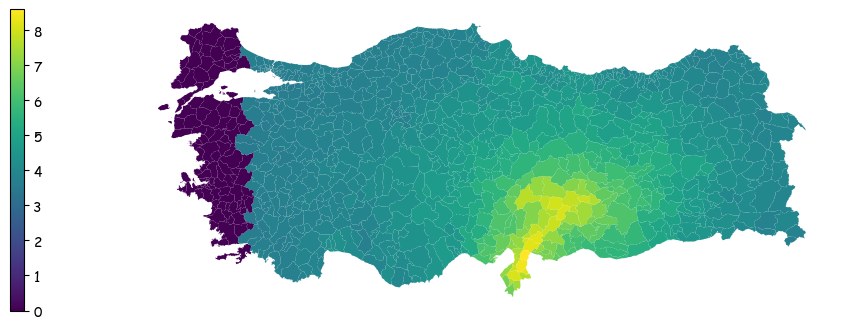
Earthquake Intensity Map of Turkiye#
Earthquake Intensity Data was obtained from version 15 from USGS and was overlayed with shapefiles of Turkey admin 2 region taken from UNOCHA. This can be used as a baseline map upon which other indicators can be visualized.
<matplotlib.colorbar.Colorbar at 0x1cf34635720>