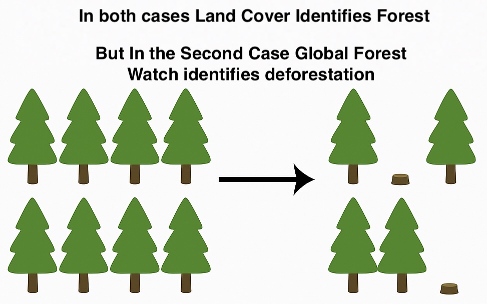
🧭 Why Land Cover Change and GFW Deforestation May Show Different Results#
When comparing land cover change derived from products like GLC_FCS30D with deforestation alerts from Global Forest Watch (GFW) based on the Hansen Global Forest Change v1.10, discrepancies often emerge. These differences are not necessarily contradictions but reflect variations in definitions, methodologies, and detection objectives.
Author: Pietro Milillo, Assistant Professor, University of Houston and Short Term Consultant for Worldbank
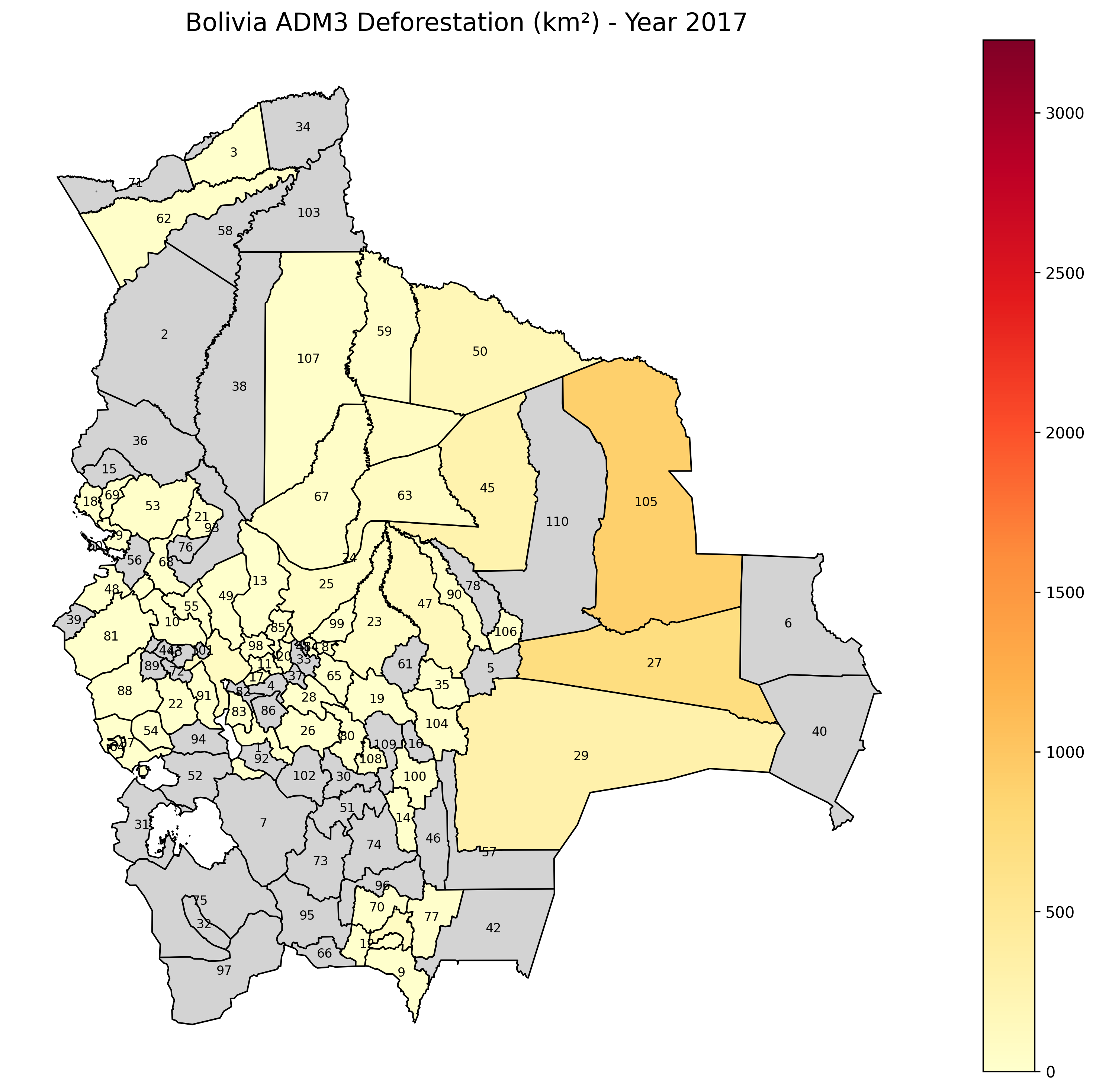
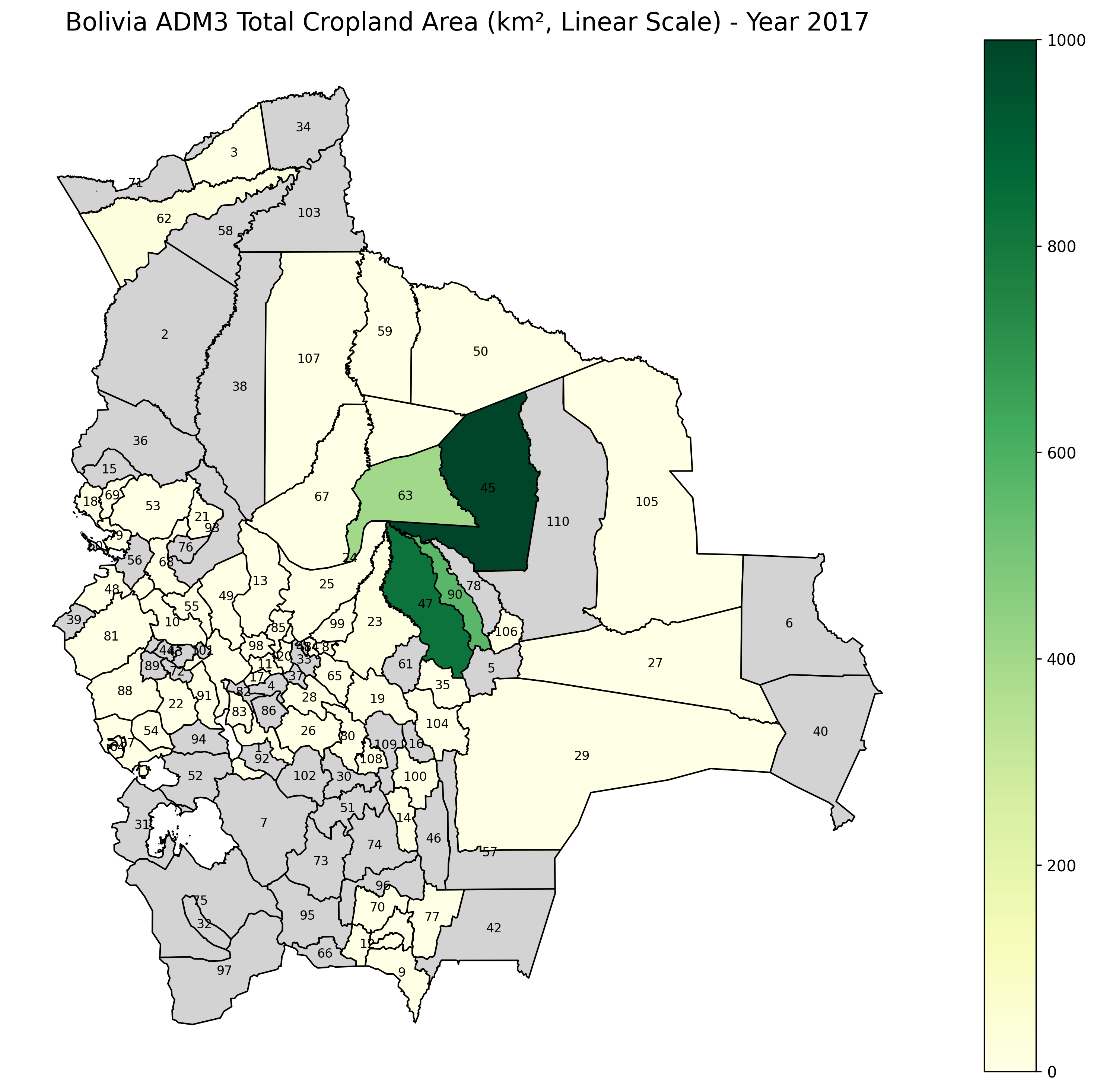
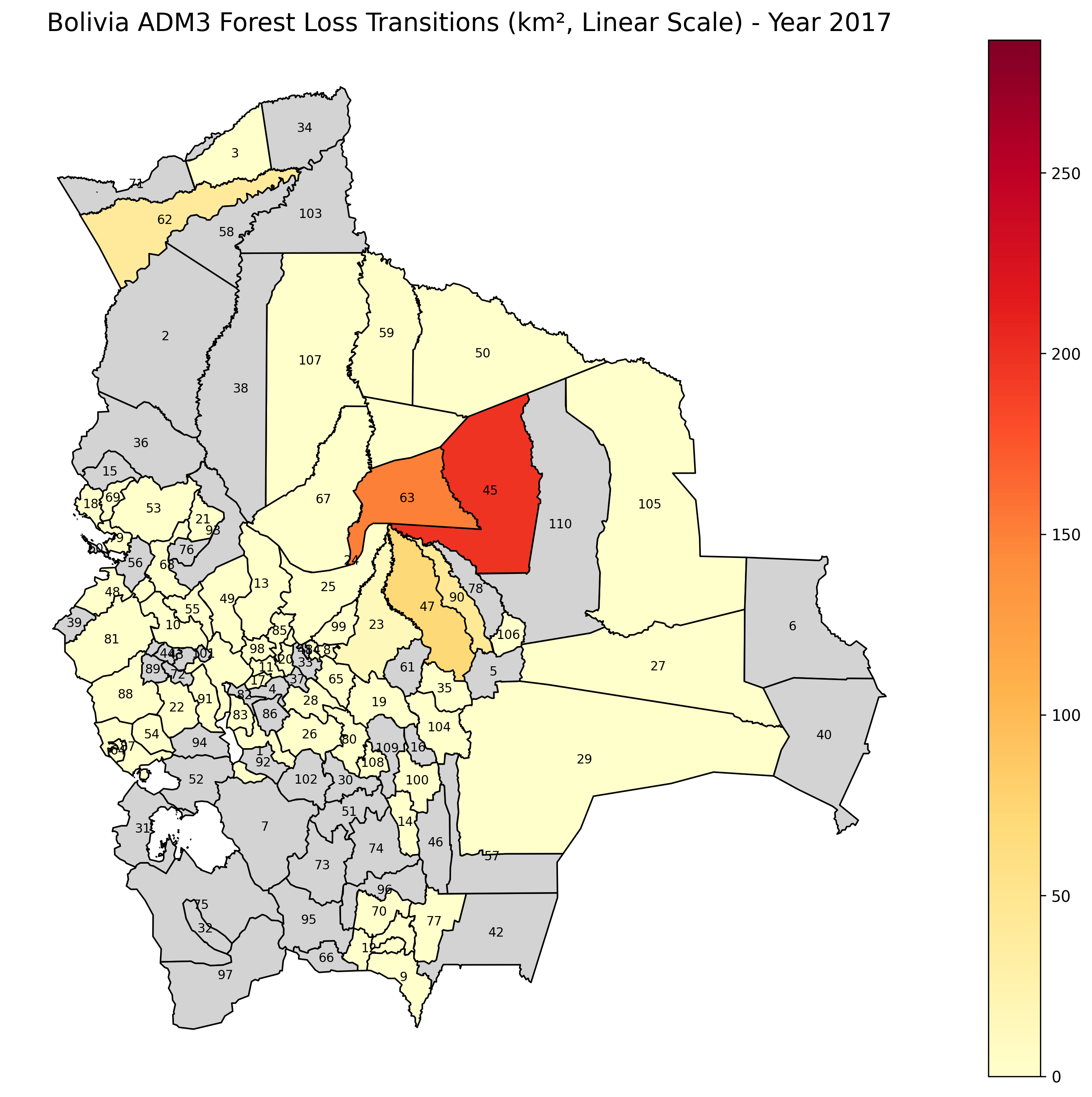
Display of Global Forest Watch 2017 loss (left) Cropland Area map GLC_FCS30D (center), Boliva Forest Loss Land CoverGLC_FCS30D (right)
|
|
|
|---|
🧪 Hypotheses for Discrepancies#
Different Definitions of “Forest” and “Deforestation”
GFW defines “forest” as areas with >30% canopy cover and identifies tree cover loss, including logging, fire, agriculture, or natural events.
Land cover products may categorize forest based on land-use and vegetation type (e.g., distinguishing shrubland, wetlands, or agroforestry), which may not register subtle canopy changes.
Temporal Resolution and Update Frequency
GFW updates annually but highlights abrupt tree cover loss.
Land cover maps (e.g., GLC_FCS30D) often apply temporal smoothing, which may delay the detection or omit short-term or transitional losses.
Sensor and Algorithm Differences
GFW uses Landsat with spectral indices optimized for forest change detection.
GLC_FCS30D incorporates multiple sources (Landsat + MODIS) with hierarchical classification and may prioritize land use stability over abrupt changes.
Cloud Cover and Shadow Effects
Optical datasets like Landsat and MODIS are susceptible to cloud cover; processing may introduce uncertainty in tropical or mountainous regions.
GFW includes quality masks but can still misclassify areas with persistent cloud cover.
Small-scale or Gradual Change Detection
GFW captures abrupt tree loss, while land cover maps may smooth out or miss gradual degradation or mixed-use patches (e.g., selective logging, agroforestry).
🔍 How to Interpret These Differences#
Complementary Use
Treat GFW and land cover maps as complementary tools. Use GFW for detecting short-term, sudden tree cover loss, and GLC_FCS30D for understanding land use conversion trends and longer-term stability.Cross-Validation Strategy
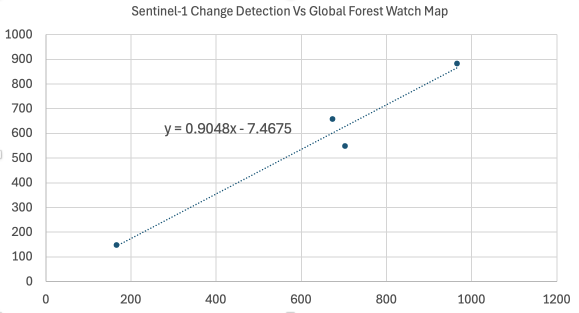
Compare overlapping trends spatially rather than expecting identical results. Look for hotspots of agreement and flag disagreement zones for manual review or further investigation using high-resolution imagery (e.g., Planet, Sentinel-2).Use Worldbank Sentinel-1 SAR Data for Change Detection
Incorporate radar backscatter trends from Sentinel-1 to detect structural land cover changes independent of cloud contamination, adding an extra layer of validation. Preliminary testing shows good agreement.