Mapping Freetown Transit for Resiliency
by Fatima Arroyo-ArroyoWhereIsMyTransport Disaster Risk Management Transport
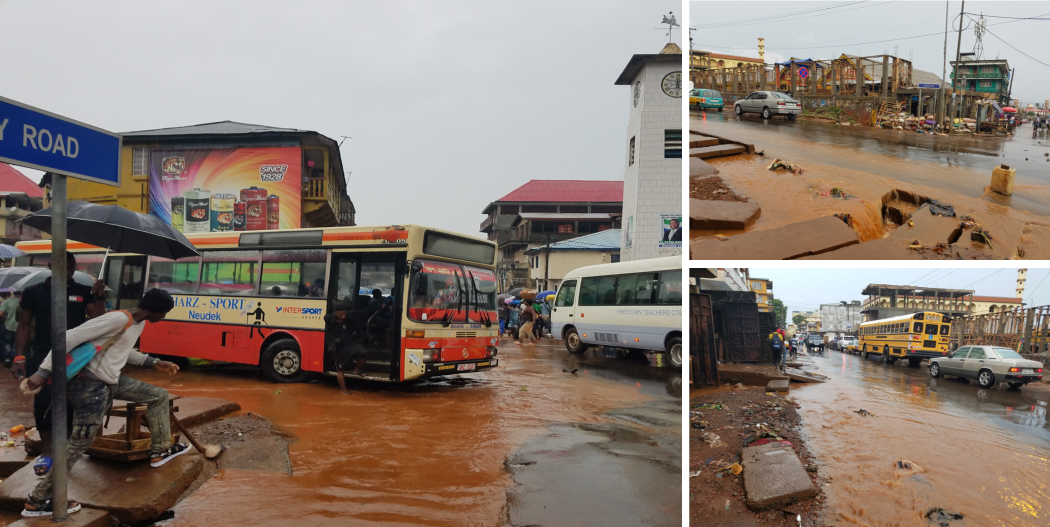
Challenge: The resiliency of a transport network is a critical component to the stability and prosperity of a city. Freetown, prone to flooding and landslides, struggles to maintain services throughout the year. Compounding the challenges of weather and scarce resources, the government did not have a comprehensive map of its entire transport system, curtailing efforts to increase the resiliency of the system.
Solution: Working with Where Is My Transport, map Freetown’s formal and informal transport network, and make the data freely available to governments, academia, and NGOs.
Impact: The local government can now identify and prioritize interventions that will enhance the resiliency of their transport system, to maximize economic and social benefits.
With 1 million people and 30% of Sierra Leone’s GDP, Freetown is a vibrant West African city with a growing population and economy. Much of the city’s economy revolves around its natural deep-water harbor – one of largest in the world, supported by its network of formal and informal transit.
Freetown’s development and growth rests upon the resiliency of the city to rebound from climate shocks. As one of the world’s most vulnerable cities to flooding, the Government of Sierra Leone recognizes that a resilient transport network is a critical component to the future prosperity of Freetown. To this end, in the autumn of 2018, the World Bank team, led by Fatima Arroyo Arroyo and Xavier Alegre, set out to assess the strengths and vulnerabilities of Freetown’s entire transport network.
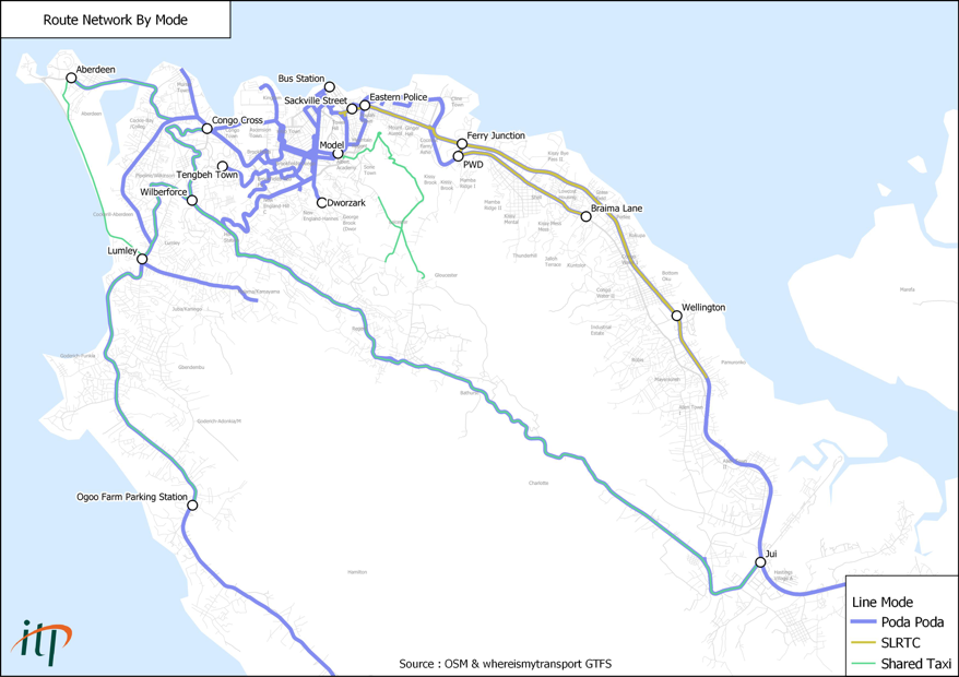
As the team noted in a recent report about Freetown’s transit services, “The informal transit network of Freetown [has] little visibility to both city planners and the people it serves.” With this obscurity, no vulnerability assessment could begin overnight. The team needed to map Freetown’s complete network of transport routes – both formal and informal.
This would be the first comprehensive transit map for Freetown and would inform everything from infrastructure policy to journey planning. But a static snapshot of this changing system was never the (proverbial) destination. It was important to the Sierra Leone team that the transport map be the foundation of ongoing analysis, development, and processes that could adapt to a changing city. As Arroyo Arroyo noted at the World Bank’s Data Day in February 2019, “We expect that this doesn’t end here. This is the beginning of a long story.”
The Data Partnership had already partnered with WhereIsMyTransport, a startup founded in South Africa with years of experience mapping formal and informally-run transport networks. Since 2008, WhereIsMyTransport has worked to build tools and methodologies that empower and apply local knowledge to the challenges of urban mobility.
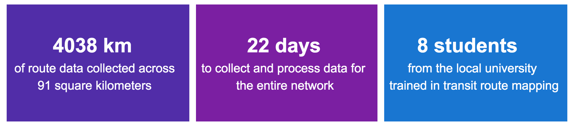
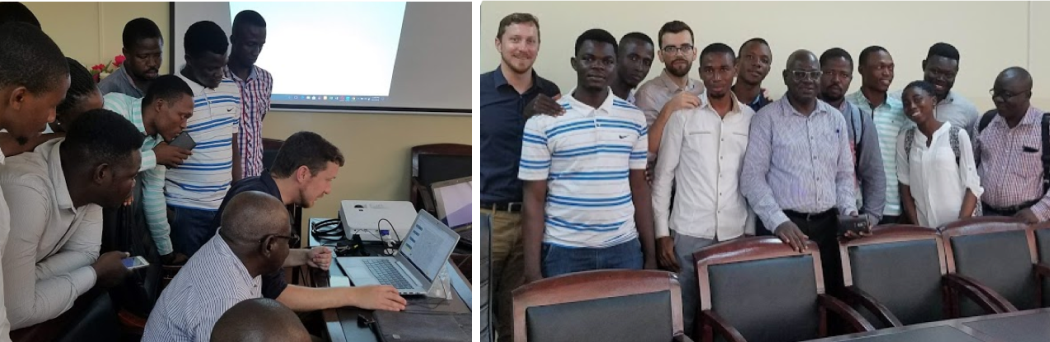
Because of this existing relationship with WhereIsMyTransport, the team in Sierra Leone was able to leapfrog a multi-month process of collecting and processing Freetown route data. The World Bank team worked with WhereIsMyTransport to train university students from Fourah Bay College to collect 4,038 km of formal and informal bus, taxi, and ferry tracks over the course of 13 days. Instead of months, the transport data collection and processing timeline happened within the matter of a few short weeks.
The Data Partnership platform allowed the government of Sierra Leone to begin a vulnerability assessment without data as a bottleneck. With the routes mapped, the government could now determine how, where, and when the supply of public transport is affected by climate impacts. As Arroyo Arroyo continued “I see that the world is changing so fast. We really need risky ideas to be able to catch up. We need innovation to come into our projects.”
From infrastructure development to health services, the Freetown transport map is now critical to the work of city officials and university curriculum. The data has also become a resource for the public. Because a complete map of the informal and formal transit network is available for the very first time, several developers across all of West Africa are building apps to improve civic decision-making and journey-planning.
The more resilient transport services are to climate impact, the more a city is able to adapt, and the more people are able to access economic opportunity and social services regardless of change.